

Urban buses, intercity buses, night buses and commuter trains in 2014. The Regional Transport Consortium has released a new transport map so you don’t miss in your daily trips within the Community of Madrid.
In the last few months urban bus lines in Alcalá de Henares have undergone some changes, with a cut of 10% in frequency of its lines and the expansion of others.
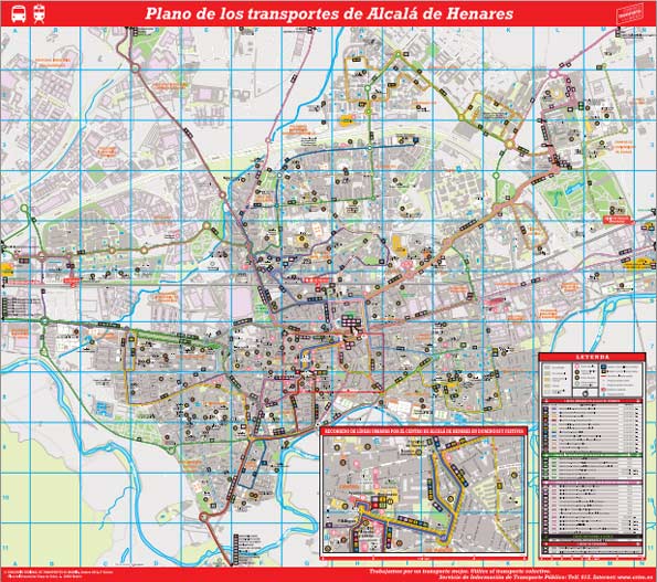
To see or download the new Transportation Map of Alcalá de Henares, click the map:
For more information on city buses, click Urban Buses in Alcalá.
If you want to calculate all the possible connections between two points of the Community of Madrid with information on transport schedules and prices, click on Public Transport in Madrid.
Respect to the line 824 which connects with Alcalá de Henares with the Madrid-Barajas Airport, you can get detailed information here: To the Airport by Bus.
Sigue disfrutando de Dream Alcalá:
- Telegram: Recibe nuestras noticias y contenido exclusivo (clic aquí).
- Newsletter: Recibe cada tarde un correo con nuestras últimas noticias (clic aquí).
- YouTube: Suscríbete para ver nuestros mejores vídeos (clic aquí).